
Maps
I am interested in maps as vehicles for narrative. The maps I create describe personal or imaginary journeys. A map is always an edited version of a story, always subject to revision, always open to interpretation, often tempted by exaggeration. Fine detail and embellishment are the territory of both cartography and embroidery.
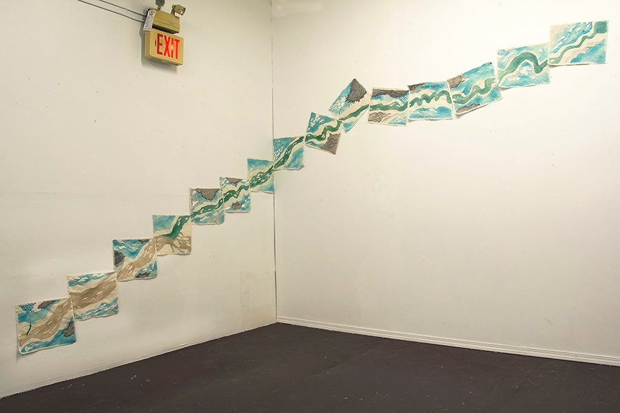
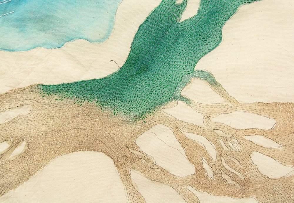
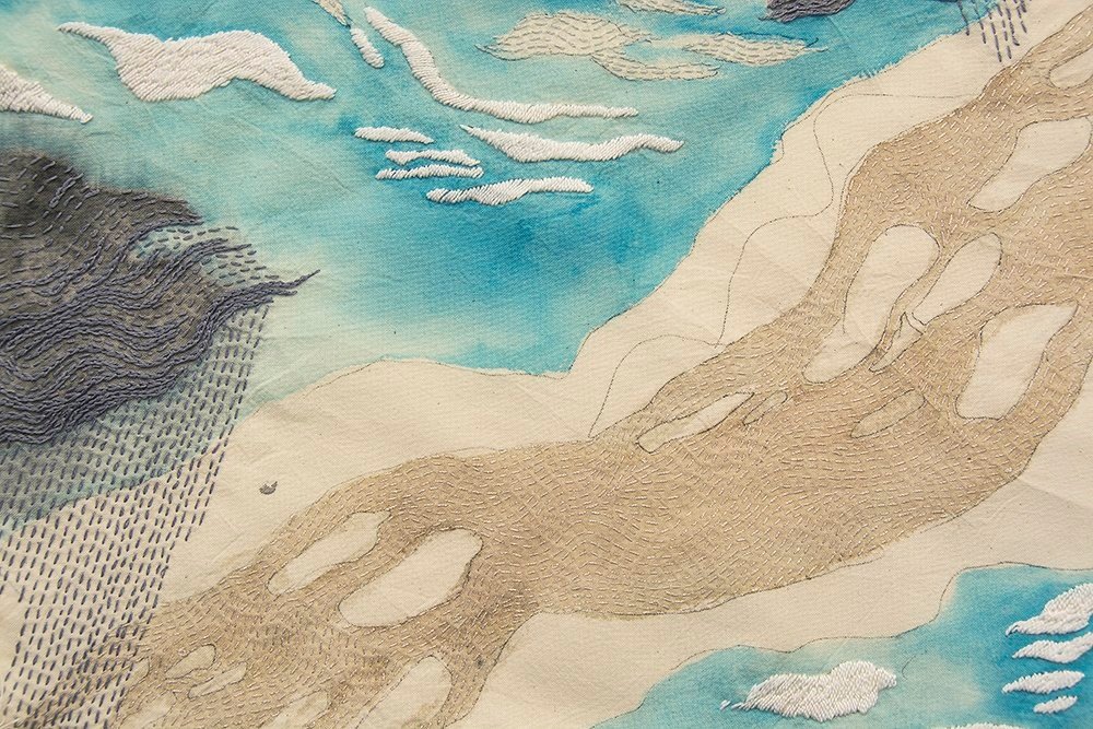
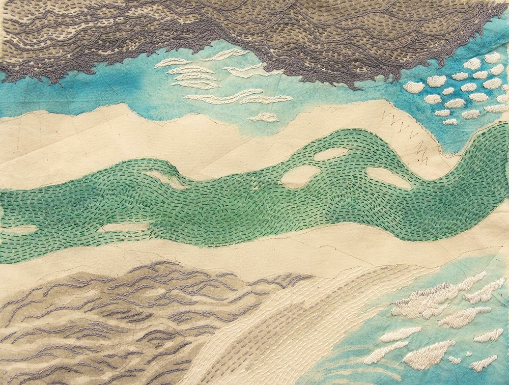
Canadian Wilderness Artist Residency - Yukon River
Paddling the Yukon River in 2019 from Lake Laberge to Dawson City with 11 exceptional artists. I prepared cotton pieces beforehand and drew our passage on one per day of our journey. They begin top left, and although we were travelling north, they descend as we went downriver. Later, when I painted and embroidered the pieces, I found the river and skies stayed with me more than the landforms.
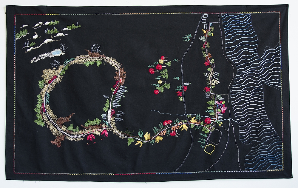
Wallace Stegner House Residency
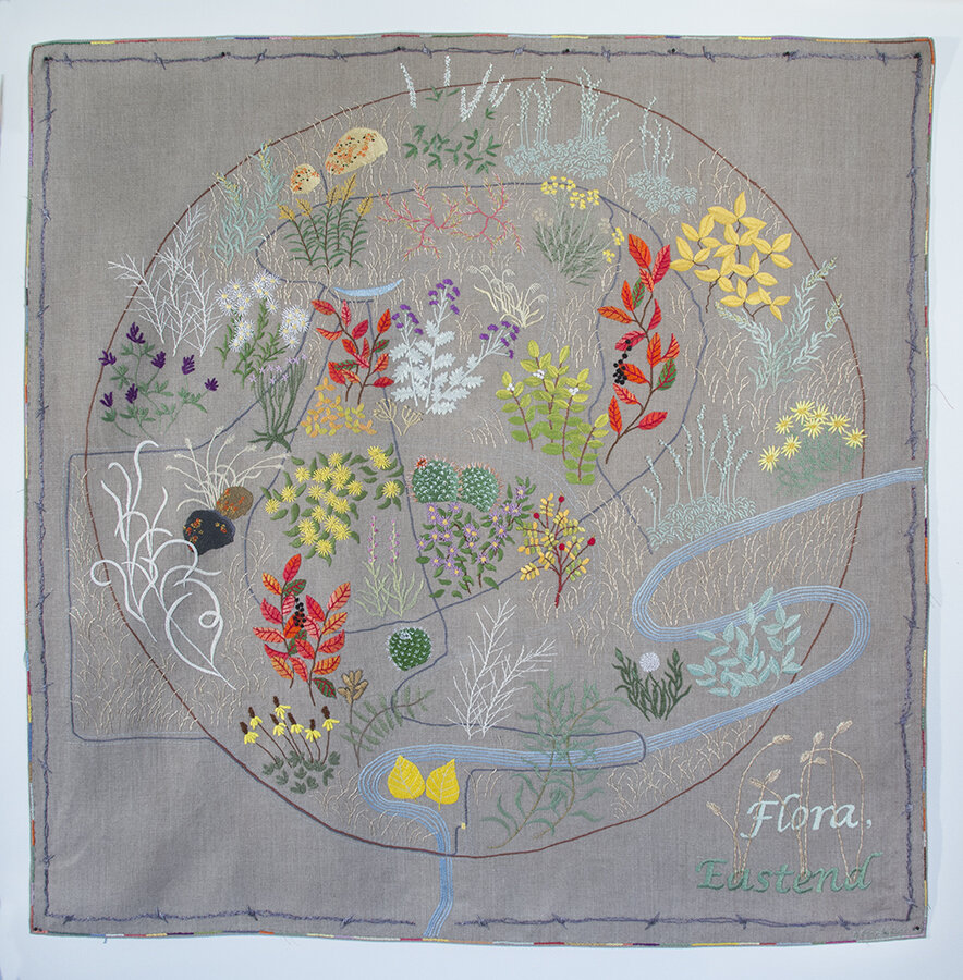
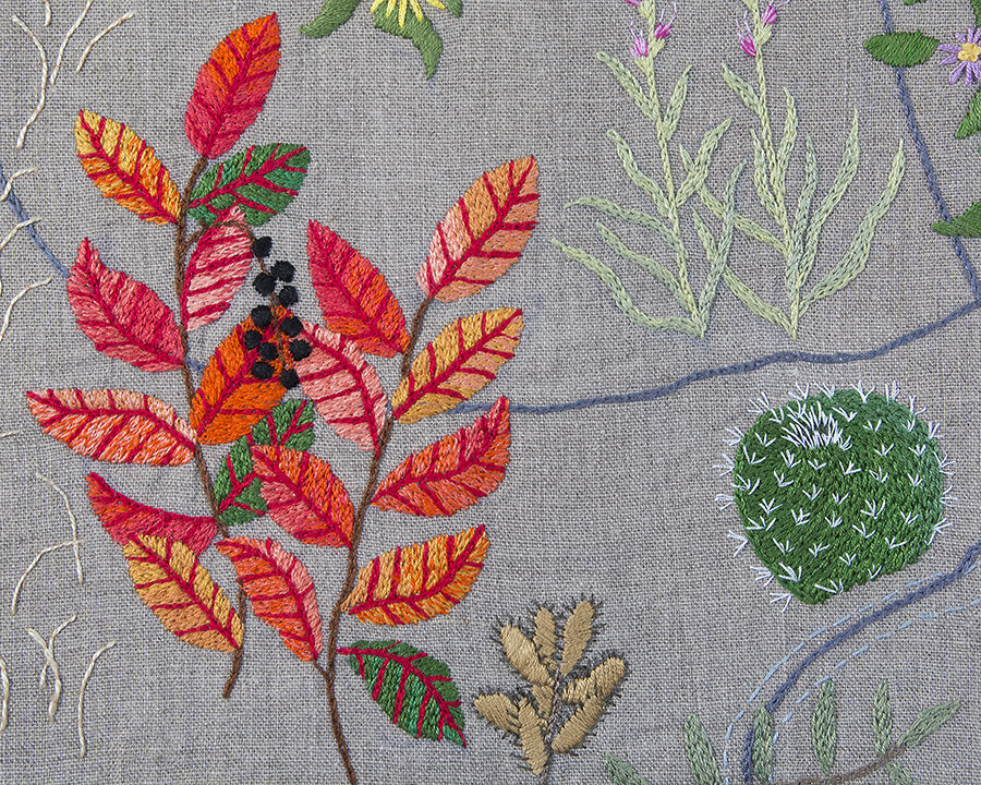
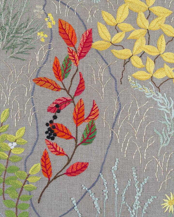
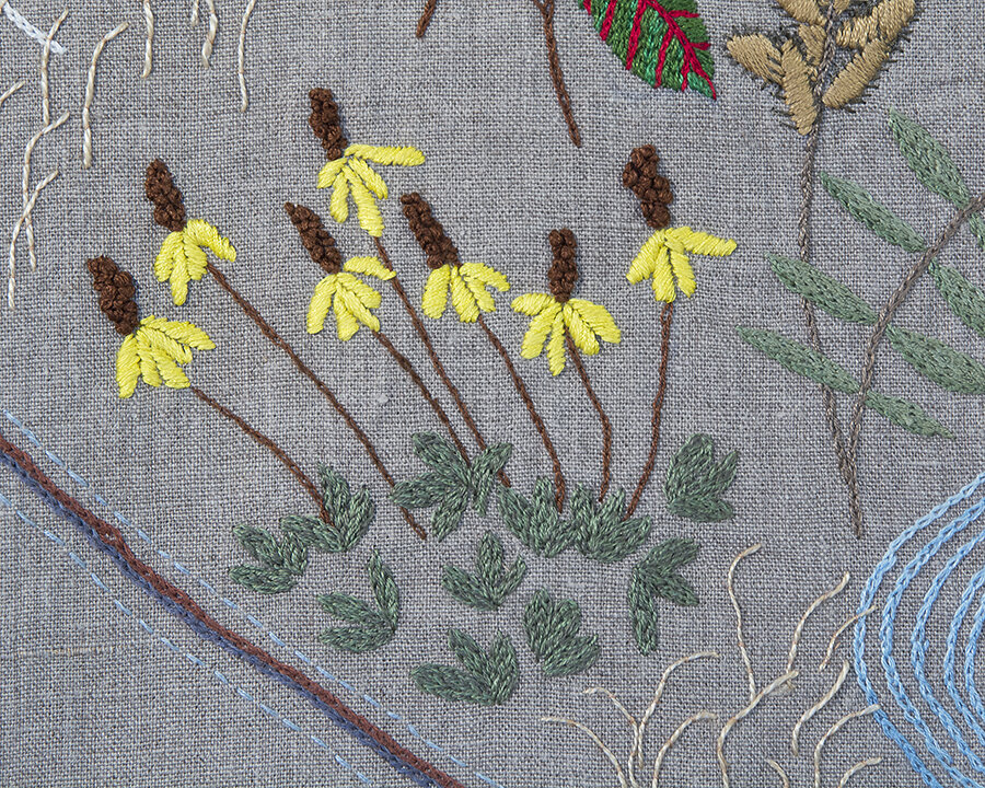
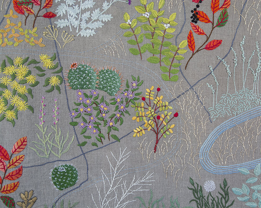
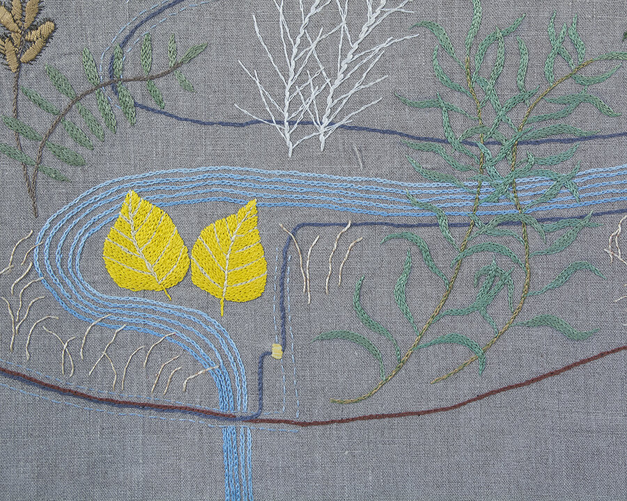
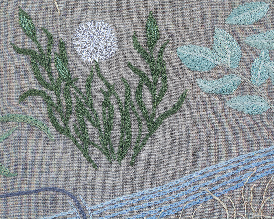
At my residency in Eastend Saskatchewan, I learned to identify some of the local flowers. I embroidered Flora, Eastend, a map of my daily walk around the hillside near the house.
The Lookout Trail
is a map (2016) of a trail I hiked when I was an Artist-in-Residence at Gros Morne National Park on the west coast of Newfoundland.
Schmetterlinge
are weather maps portrayed on the Waterman Butterfly global projection. All twelve are under my project “Weather”.

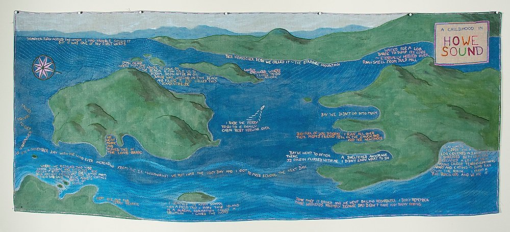
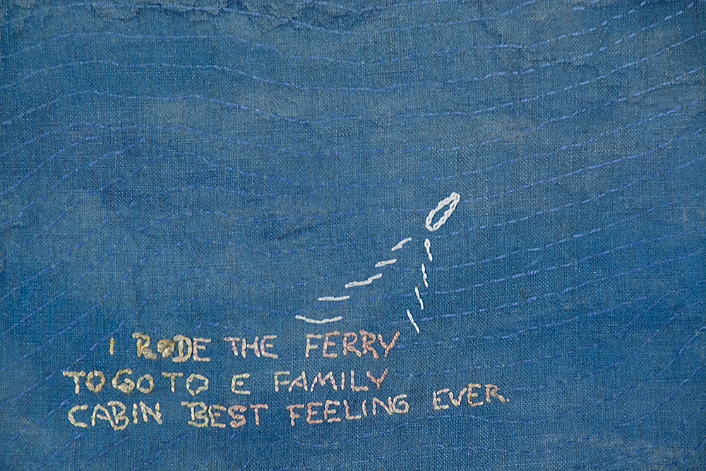
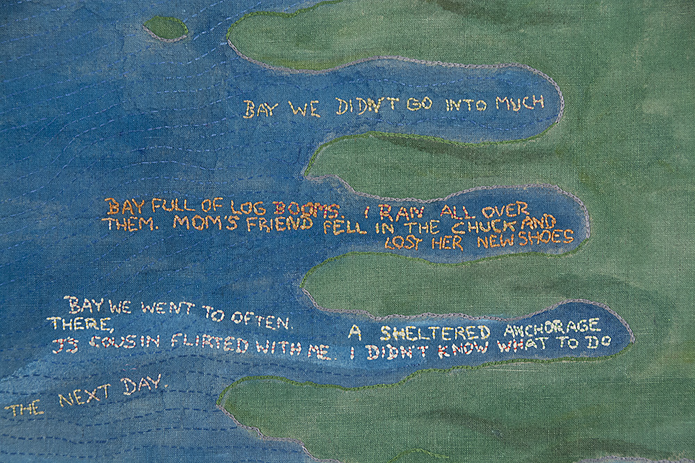
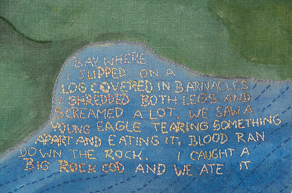
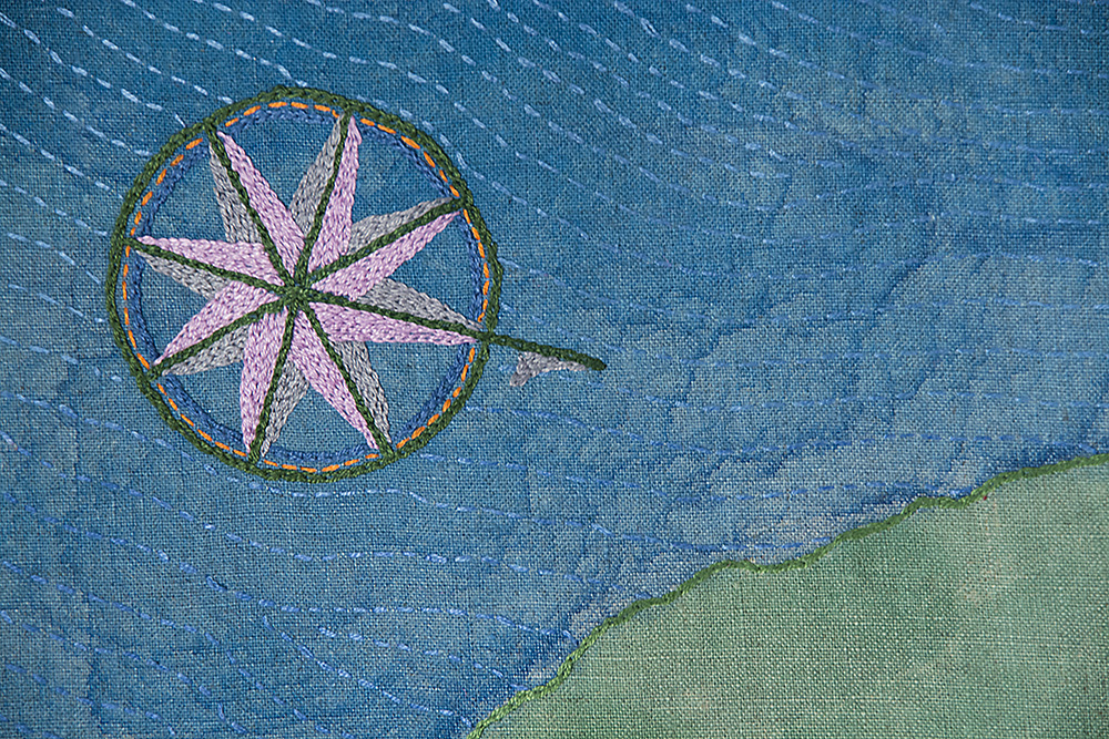
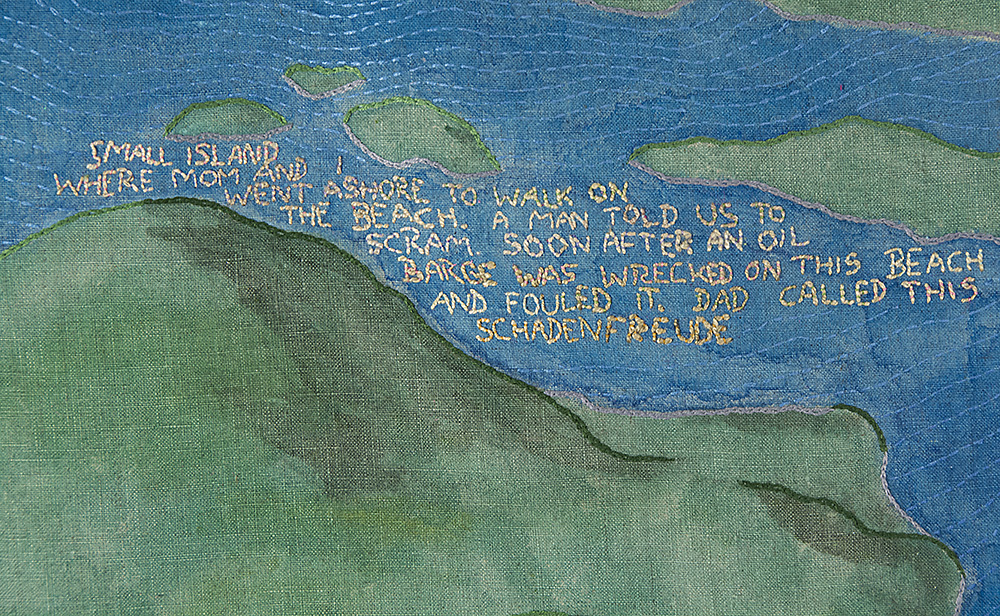
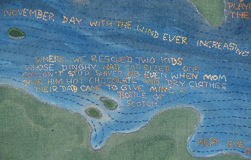
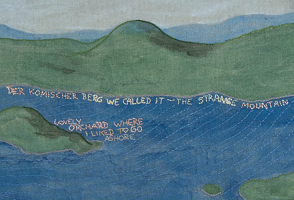
A Childhood in Howe Sound
dwells on childhood memories of sailing. The land is empty of text because everything, as I remember, happened on the water.
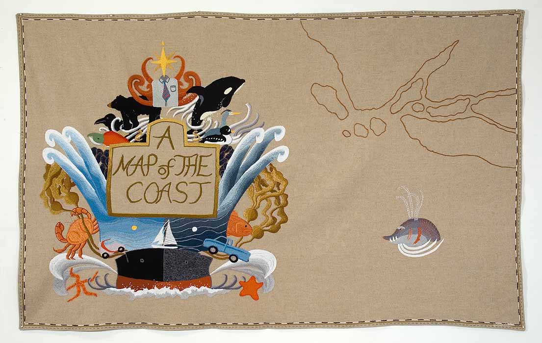
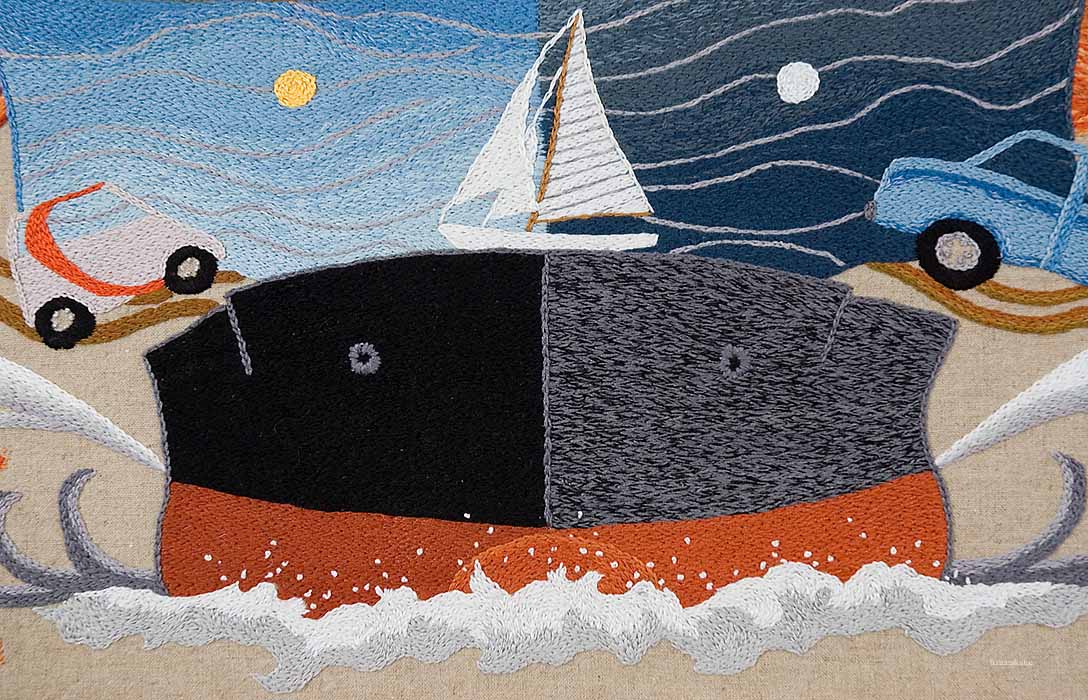
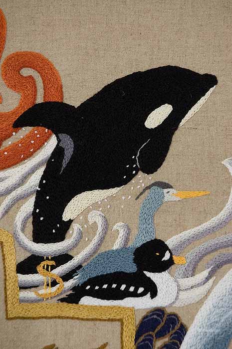
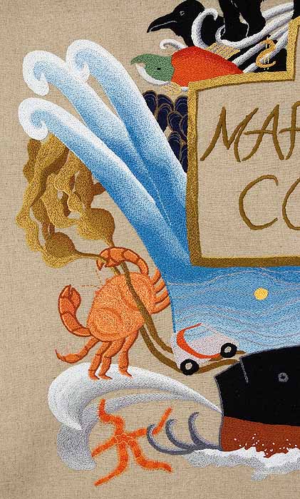
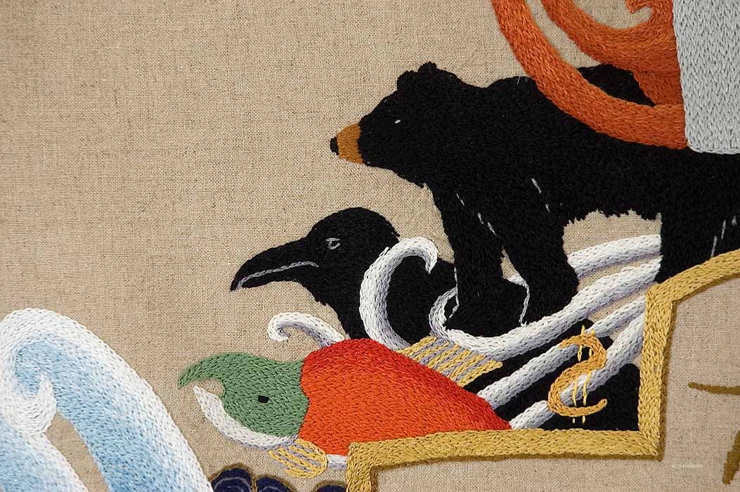
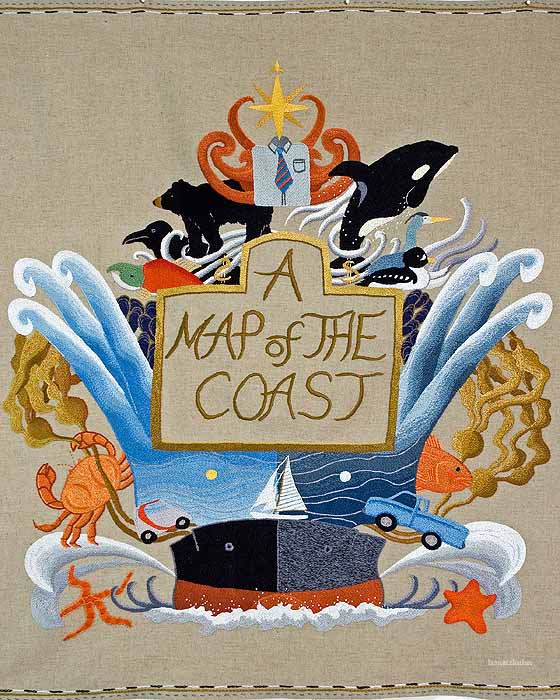
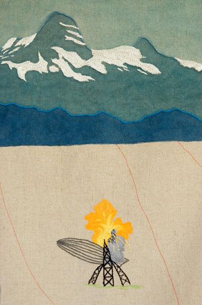
A Map of the Coast
was inspired by old maps whose cartouches (title decorations) are extravagant. Here, it has taken over the map, as have the discussions around pipelines on Canada’s west coast.
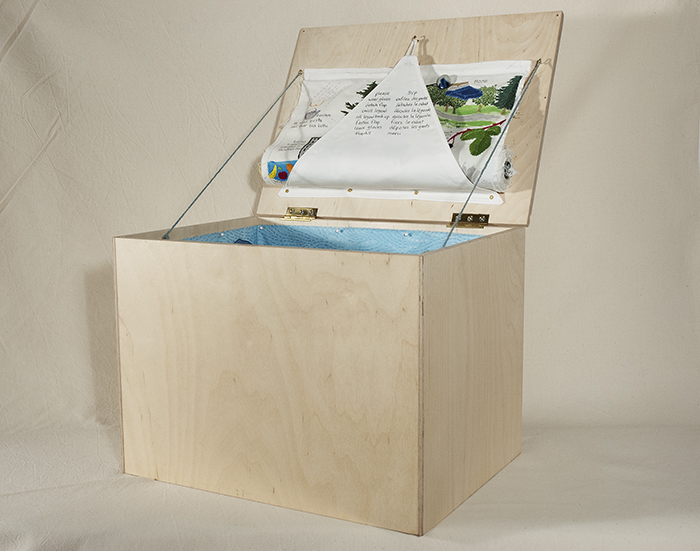
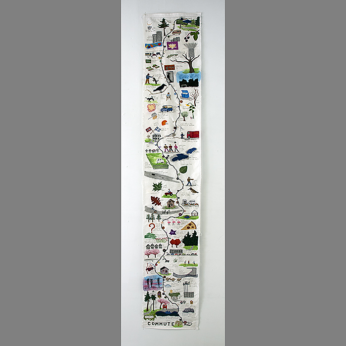
Commute
was made for the "Boxed In!" exhibit in St John's NFLD. All work had to fit into a box that was maximum 41 x 41 x 46cm. The map which lines the box, traces my bicycle commute to my part-time job. The legend, listing things I encounter, links to the map . The legend became so long, I had to roll it up under the lid and design a contraption to hold it. Viewers are invited to put on gloves and unroll the legend.
assorted embroidered maps:


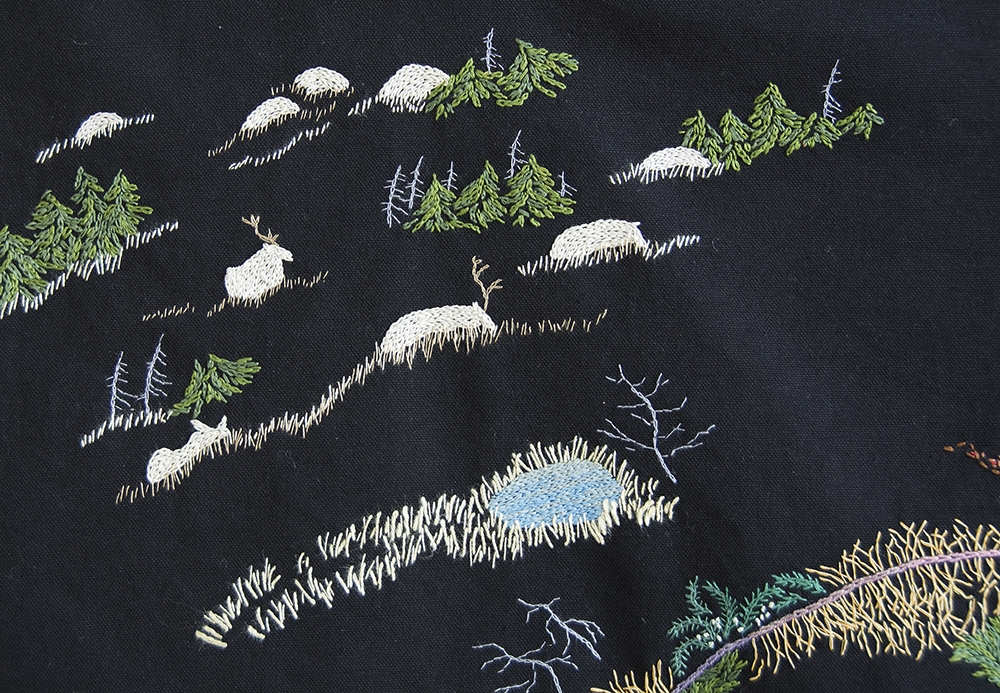
Banff Maps
At a residency at the Banff Centre for the Arts , I worked on maps made with layers of fabric to describe human and animal interactions. I also made Legends, five strips using imagery I transformed from the various legends on local maps. Some of the symbols describe the land, others prioritize human comfort and convenience. On one, I gathered all the “don’t” symbols.


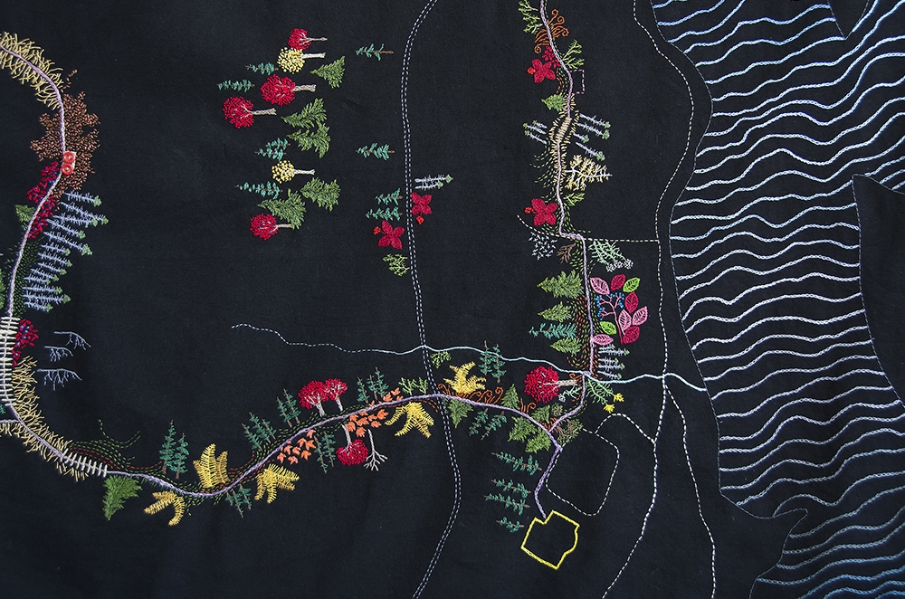
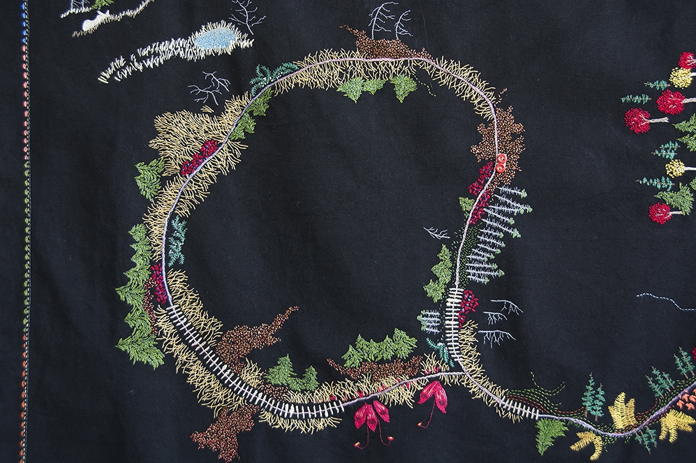
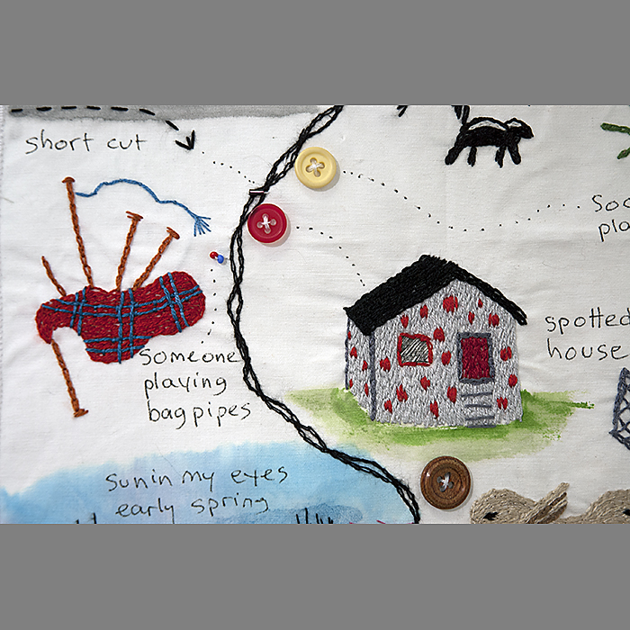
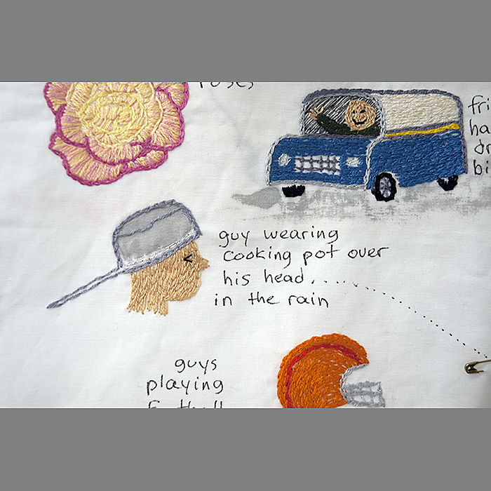
The Bike Trip
Years ago, I undertook a solo bicycle trip from Vancouver to the Yukon (2300km). Spool is a length of cloth I prepared ( one cm for each kilometre) and as I traveled, I drew what had transpired that day. After the trip, I embroidered what I remembered best, emphasizing some things and forgetting others....the way memory often works. I continue to embroider what I recall on the spool.
The Bike Trip Map acknowledges the kindnesses people offered me. Often, at rest areas or campsites or even in the middle of the road, people would offer me food, something to drink, or just encouragement.


